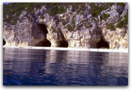
 Cala Luna Cala Luna |
|
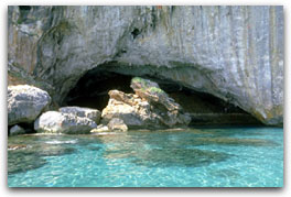
It is not easy to leave the
spectacular Cala Luna but luckily nature has many other surprises. For example; Cala Sisine
(where the scenery of the thick oleander bushes is repeated) and the next bay of Cala Mariuolu
which is made up of small coves where the beaches are formed by small circular stones that
get smaller and smaller as we go towards the shoreline.
|
There is a legend that the name
"Mariuolu" was given to this area because there was a very cunning seal, that was able to
devour in a few seconds clandestinely the daily catch of the fishermen ( in the local language
'Mariuolu' means thief). In these waters there is the region called Ogliastra, which is probably
the most difficult part of Sardinia to reach because of its rough terrain and poor road and rail
links. An island within an island, as the local people use to define Ogliastra to highlight the
differences that characterised this area compared to the rest of Sardinia.
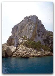
The calcareous rock cliffs accompany us as we round Capo di Monte Santu, which with Capo
Bellavista marks the Gulf of Arbatax.
|
|
Cala Luna |
Cala Mariolu |
|
Sailing at night the lights of
Baunei can be clearly seen. Baunei is a coastal village, whose population lives principally on
cattle-breeding even if, recently, (like Dorgali) a tourist centre has developed between Baunei
and Santa Maria Navarrese.
The plateau of Baunei is very interesting. On an excursion one can visit the small ancient
church of San Pietro and look in wonder at the chasm of the Golgo, called S'Isterru, that
plunges for about 280 metres into the depts of the earth and is one of the longest in
Europe.
|
|